Hill of Tara Aerial Images
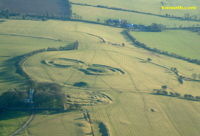
The Hill of Tara is one of Ireland's principal ceremonial landscapes. Activity here spans from the Neolithic Mound of the Hostages to Iron Age and early medieval earthworks associated with kingship and ritual. Aerial views make the relationship between these monuments especially clear.
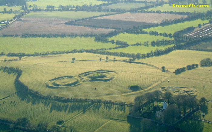 Hill of Tara aerial view.
Tech Midchúarta, traditionally known as the Banqueting Hall, is a linear earthwork approximately 203 metres (666 feet) long, with parallel banks separated by between 25 and 28 metres (82 to 92 feet). The name derives from medieval Irish literature, which described the monument as a great royal banqueting hall.
During the twentieth century, some archaeologists compared the monument with the Neolithic cursus monuments of Britain and Ireland and suggested that it might belong to the same period as the nearby Mound of the Hostages. However, the earthwork has never been excavated and no direct dating evidence is available.
More recently, Conor Newman has argued that Tech Midchúarta formed a ceremonial avenue controlling movement towards the summit of Tara, rather than a Neolithic cursus. He suggests that it belongs to a later phase in the development of the royal complex, possibly during the early medieval period. In the absence of archaeological excavation, its precise date remains uncertain.
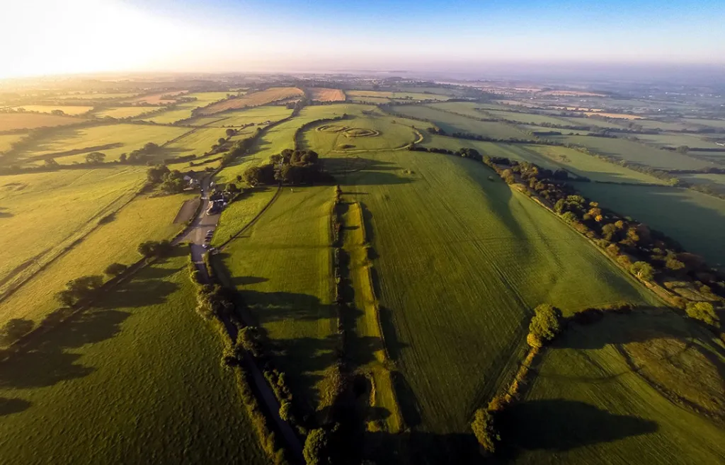 Tech Midchúarta, the Banqueting Hall: a ceremonial avenue rather than a feasting hall.
Ráth na Ríogh, the Royal Enclosure or Fort of the Kings, is a large oval earthwork dating to the Iron Age, probably the first century BC. Its ditch lies inside the bank, an arrangement usually taken to indicate ceremonial rather than defensive purpose. Within it stand An Forradh (the King's Seat), Teach Chormaic (Cormac's House), and the earlier Mound of the Hostages.
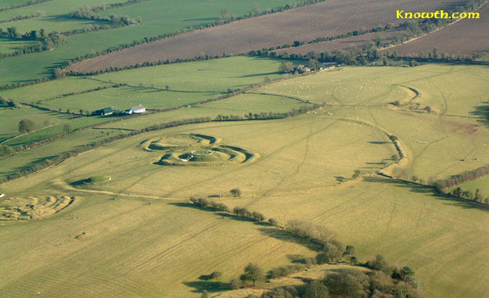 Hill of Tara - Royal Enclosure (Ráth na Ríogh).
Immediately north of the Mound of the Hostages is Ráith na Senad, the Rath of the Synods, a multivallate enclosure occupied between the first and fourth centuries AD. Excavation recovered Roman artefacts here. The monument was severely damaged around 1900 by British Israelites digging in search of the Ark of the Covenant. The present churchyard cuts into its eastern side.
 Hill of Tara - The Rath of the Synods.
More Hill of Tara aerial images, Royal Enclosure views, and Rath Gráinne and Rath Lóegaire.